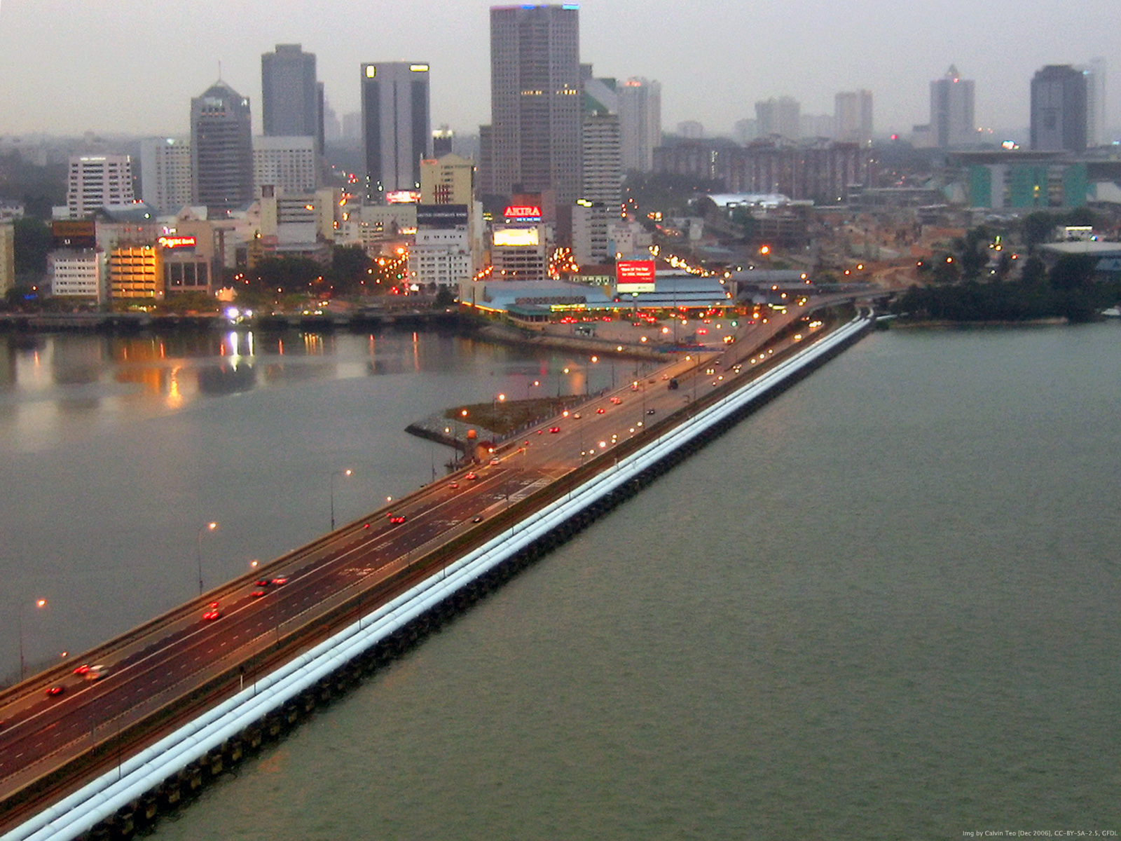
AGSE 2012 & FOSS4G Southeast Asia Johor Bahru, Malaysia
Geoinformation – Catalyst for planning, development and good governance
July 16 – 20, 2012
Geoinformation – Catalyst for planning, development and good governance
July 16 – 20, 2012
Geoinformation – Catalyst for planning, development and good governance
Prof. Dr. Franz-Josef Behr, Stuttgart University of Applied Sciences, Germany, Alumni Representative, Prof. Dr. Alias Abdul Rahman, Universiti Teknologi Malaysia, Johor Bahru, Malaysia, Mirka Zimmermann M. Sc., Stuttgart University of Applied Sciences, Germany, Dr. A. P. Pradeepkumar, Dept of Geology, University of Kerala, Trivandrum, India 695581, Representative Stuttgart Active Alumni Group (SAAG)

Prof. Dr. Alias Abdul Rahman, Assoc. Prof. Mohamad Nor Said, Dr. Pawel Boguslawski, Mr. Shahabuddin Amerudin, Mr. Muhammad Uznir Ujang, Mrs. Nurul Hawani Idris, Sr Mohd, Rozi Latib, Sr Hazri Hassan, Mr. Behnam Alizadehashrafi, Mr. Khairul Hafiz Sharkawi, Mrs. Nor Suhaibah Azri, Mrs. Latifah Ibrahim, Mrs. Sarybanon Abd. Ghani, Mrs. Dewi Narty Mohd. Ikhsan, Mr. Seiw Changxi Bernard, Mr. Edward Eric Duncan, Mr. Baig Siddique Ullah, Ms. Nur Amalina Zulkifli
Prof. Dr. Franz-Josef Behr, Prof. Dr. Alias Abdul Rahman, Mirka Zimmermann M. Sc.
Prof. Rainer Kettemann, Prof. Dr. Michael Hahn, Prof. Dr. Dietrich Schröder, Stuttgart University of Applied Sciences, Stuttgart, Germany
Dr. Sajid Pareeth, Toya Nath Baral, Christine Brönner, Prof. Dr. Michael Hahn, Alvand Miraliakbari, Chembe Chisense, prof. Dr. Jaishanker Raghunathan Nair, Detlev Wagner, Naomi E. W. Litaay, Patrick Wetarni Adda, Mark Kipkurwa Boitt, Rainer Kettemann, Shahid Parvez, Gertrud Schaab, Mark de Blois, David N. Kuria, Moses Murimi Ngigi, Gabriel Vincent Sanya, Dietrich Schröder, Md. Abu Syed, Charles Buberwa Buzarwa, Anusuriya Devaraju, Hala Adel Effat, Johannes Engels, Faith Njoki Karanja, Sooraj Nediyaparambath, Muhammad Naveed Tahir, Sonam Tashi
The conference would not have been possible without the collaboration and support of different people and organizations. The organisers would like to express their gratitude to the Faculty of Geomatics, Computer Science and Mathematics, Stuttgart University of Applied Sciences, especially Beate Baur, Hildegard Gooss, Roland Hahn, Ole Mensing, Jörg Hepperle, Uwe Sauerbrey, Iris Krüger and Ulrich Walter.
The support of all sponsors (see website), especially the Federal Ministry for Economic Cooperation and Development (BMZ) and the German Academic Exchange Service (DAAD), is gratefully acknowledged.
Special thanks to Mirka Zimmermann for her proactive and dedicated management of the organisational issues and for keeping the contact to the participants. Sajani Joshi, Trillium Levine and A. Shamila Jayasekare have done a great work while formatting the submissions.Since 2008, AGSE is bringing together experts from around the world, AGSE fosters collaboration on cutting-edge research and practical applications in geospatial technologies, remote sensing, and GIS to address pressing global challenges.
The conference is closely related to the Master’s Programme in Photogrammetry and Geoinformatics with a global network of about 550 alumni. Since its beginning, the course is supported by the German Academic Exchange Service (DAAD) in its program for Development-Related Postgraduate Courses (EPOS).
Christine Brönner received her MSc. in Geography from the University of Mainz in Germany in 1993 and since then has been involved in the design, development and use of geographic information systems in many domains. She has worked with private companies and international research and education institutions in Europe, such as for the International Institute for Aerospace Survey and Earth Sciences (ITC) in The Netherlands. Christine's expertise has been employed in technical assistance assignments for development cooperation in Asia and Africa. She has also been an Interoperability Analyst with the OGC working on the implementation of open standards in EU-projects and in EU-agencies. Her research interest lies in solving the lack of interoperability between data, mindsets and organizations that she frequently encounters in the wide variety of settings in which she works.
The Cart Before the Horse
MDGs: Geospatial technologies in disaster mitigation & faster achievement of the goals
Building local government capacity in resource planning and disaster risk management through free and open source geospatial technologies
Open Source as a an attitude and the approach of OSGeo
The role of an OSGEO laboratory and the usage of OSGeo Live CD
Open-Source Geospatial Foundation: Open Source Tools and Application in Southeast Asia
Prof. Ille C. Gebeshuber is a University Professor of Physics from Austria, Europe. She is expert in Nanotechnology, Biomimetics and Tribology. Unlike most other physicists and engineers her approach to science is wide and holistic, and inherently trans- and interdisciplinary, bridging over to biology, the arts and the social sciences. Since 2009 she has been at the Institute of Microengineering and Nanoelectronics at Universiti Kebangsaan Malaysia. Her permanent position is at the Institute of Applied Physics at the Vienna University of Technology. Prof. Ille is associate editor of the IMechE Journal of Mechanical Engineering Science (SAGE Publishing, London, UK), editorial board member of various scientific journals, author of two books on biomimetics and nanotechnology and editor of a book on biomimetics by Springer Scientific Publishing. Her research interests comprise the use of nanotechnology and biomimetics to address global challenges for humankind. She loves to go on rainforest expeditions with her students, who come from different cultures and different fields (Europe & Asia, physics, engineering, biology, veterinary medicine, applied arts, fine arts). Her research interests are located at the interface of biology, engineering and the arts, systems thinking and nanotechnology.
Spatial Analysis with Open Source - gvSIG and SEXTANTE
Implementing OGC conformant webservices using PostGIS and GeoServer
The Challenge of Climate Change & Geoinformation Solutions
Since 2008, the Applied Geoinformatics for Society and Environment (AGSE) Conference has been a leading international platform for professionals and academics in geoinformatics. Bringing together experts from around the world, AGSE fosters collaboration on cutting-edge research and practical applications in geospatial technologies, remote sensing, and GIS to address pressing global challenges.
Applied Geoinformatics for Digital Transformation and Environmental Stewardship
AGSE 2022 is incorporated into the DAAD supported alumni work of the University of Applied Sciences Stuttgart. Therefore, participants from many countries worldwide contribute with experiences from their home countries.
With the wide topic "Applied Geoinformatics for Digital Transformation and Environmental Stewardship" the summer school aims at contributions of Earth Observation, geoinformatics and geospatial science ) for ongoing digitalization in our socienties and our role in the handling of environmental changes and corresponding activities.
The concept includes invited talks by international experts in combination with presentations by participants in the mornings and workshops in the afternoons on topics related to technological developments and recent data provision by Earth Observation Systems.
The objective of the conference was to 'take the benefits of geographic information technologies to a wide canvas of applicable areas'. Since 2008 we – scientists, practitioners, students and alumni – continue this path to empower one another in a participative way.
Geospatial Technology in Times of Global Challenges
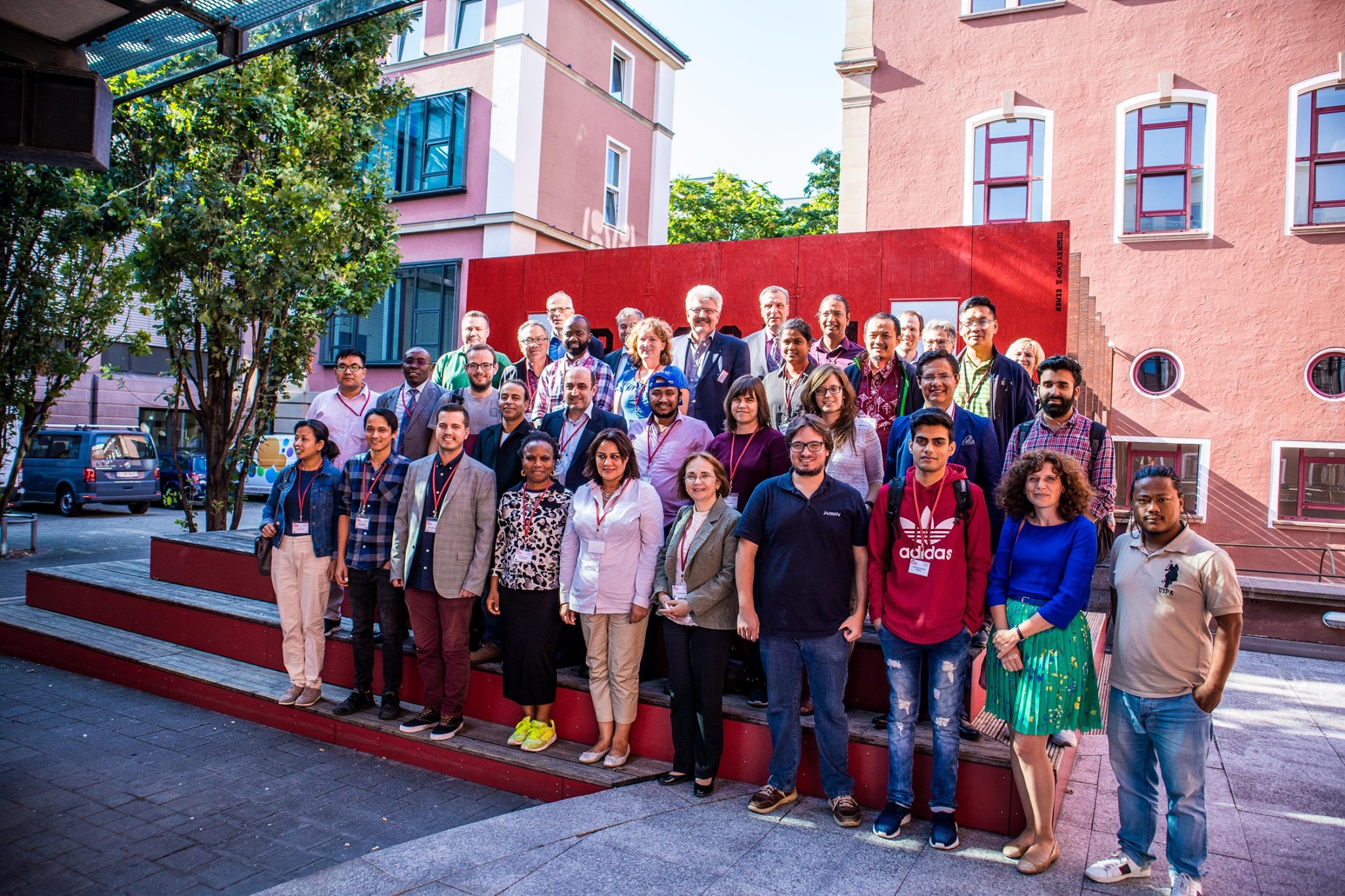
With more than 200 registered participants, AGSE 2021 (Applied Geoinformatics for Society and Environment) took place from November 24-26 as a hybrid conference – with a broadcast studio at HFT Stuttgart as well as streaming from the rooms of the partner university in Nepal, co-organized by the laboratory for interoperable and open source Geospatial software data and standards (HFT ICA-OSGeo-Lab). The continuous participation of 40 to 70 participants from (almost) all parts of the world over three days was a huge success.
The alumni conference of the master’s program “Photogrammetry and Geoinformatics” had to overcome special hurdles this year. For a long time it was not certain whether a conference in presence at Kathmandu University in Nepal would be feasible during the Corona pandemic.
The planning and preparations in summer were still based on a presence event, because everyone would have preferred a face-to-face meeting in Kathmandu. With alumni and alumnae coming from all parts of the world, an online-only conference across time zones means a big challenge: for some it’s breakfast time, for others it’s the middle of the workday, after work, and some have to get up extra in the night. But the pandemic situation ultimately forced a switch to a hybrid conference. And that is why the organizers were very pleased that 58 alumni and alumnae from almost all continents of the world were present.
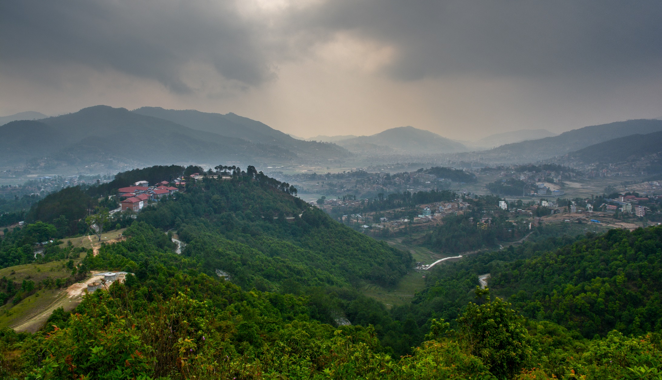
The now 11th AGSE conference was planned and implemented together with the Department of Geomatics Engineering, School of Engineering, Kathmandu University. Numerous international experts, many of them alumni of the study program, attended to listen to the interesting lectures on the topic “Geospatial Technology in Times of Global Challenges” and to exchange ideas in scientific discourse.
Mother Earth – Geoscience for Crisis Management
The organizers invited to participate and explore the potential of geospatial technology and learn how Geospatial science and IT as well as remote sensing and photogrammetry act as a positive force for governments, society and industry providing support in a wide range of topics including disaster manegement, planning, development, utility and resource management, transportation, safety and emergency response, research and analysis.
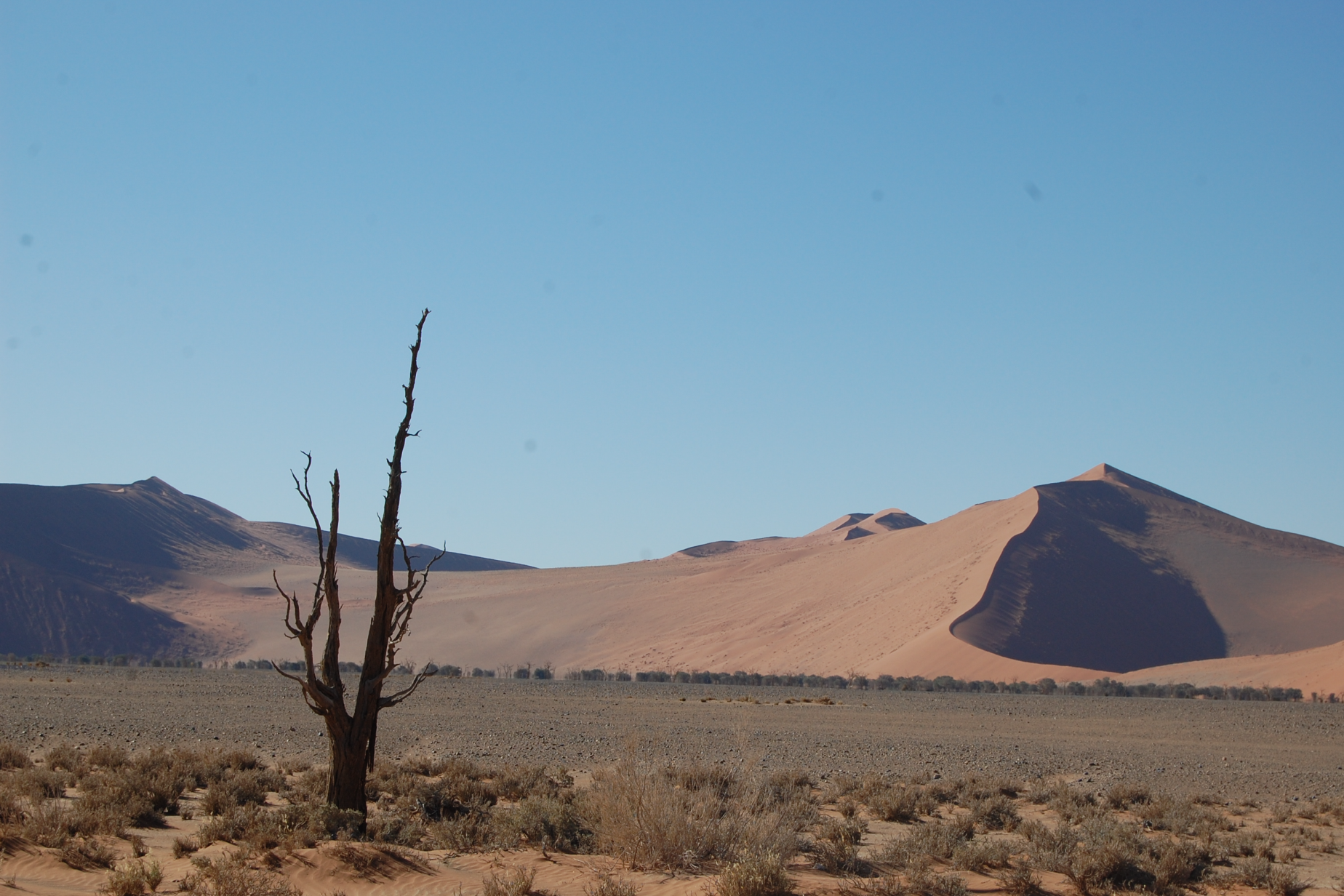
The conference was organized by Namibia University of Science and Technology(NUSTI, Windhoek, Namibia) and Stuttgart University of Applied Sdences, Stuttgart Germany, co-organized by the ICA Commission on SDI and Standards.
The Applied Geoinformatics for Society and Environment (AGSE) conference is an annual event that brings together experts in geoinformatics, remote sensing, and spatial data science.
Since 2008, the Applied Geoinformatics for Society and Environment (AGSE) Conference has been a leading international platform for professionals and academics in geoinformatics. Bringing together experts from around the world, AGSE fosters collaboration on cutting-edge research and practical applications in geospatial technologies, remote sensing, and GIS to address pressing global challenges.

AGSE 2011 is special; it is being held for the first time in Africa, and particularly so in Nairobi, Kenya, the city that hosts the headquarters of the United Nations Environmental Programme (UNEP). Besides drawing a variety of papers from the international forum of the alumni of Stuttgart University of Applied Sciences, a considerable contribution from other researchers has addressed the use geoinformatics in Africa, and more so from the host country. The scientific and application areas presented in the papers are classed into eleven broad sub-themes namely: (1) General application papers, (2) Internet-based and open source solutions, (3) Advances in GIScience and current developments, (4) Spatial data infrastructures, (5) Environmental issues and sustainable development, (6) Natural resource management, and monitoring (7) Disaster and risk management, (8) Geoinformatics in health, (9)Urban and regional planning, (10) GIS in Education, and (11) Alumni experiences and business development.
 [GFDL(www.gnu.org/copyleft/fdl.html) or CC-BY-SA-3.0 (www.creativecommons.org/licenses/by-sa/3.0/)], from
Wikimedia Commons; http://commons.wikimedia.org/wiki/File:Giraffe_-_Skyline_-_Nairobi_-_Park.jpg [2011-08-05]")
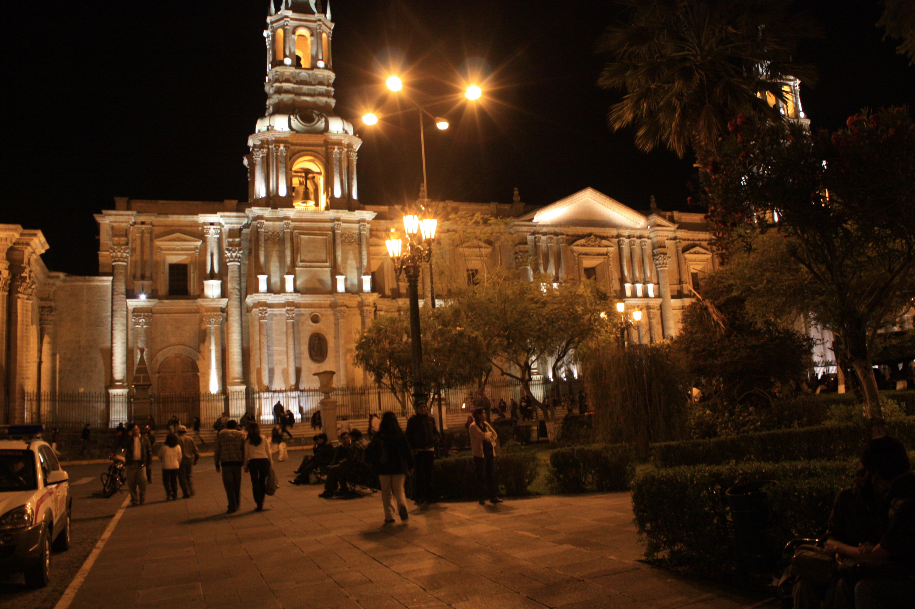
Below the El Misti volcano
The third AGSE2010 (the Third Applied Geoinformatics for Society and Environment Conference 2010) jointly organized by the Stuttgart University of Applied Sciences, Germany (SUAS) and the Catholic University of Santa Maria (UCSM) took place between Aug 3 and 6, 2010 at Arequipa, Peru, under the benign gaze of the El Misti volcano. This was the third continent the conference was travelling to in as many years, the first being in the humid tropical environments of Kerala, in southern India, within the continent of Asia; the second in the temperate zone of southern Germany in Stuttgart, in Europe. In a way this could be record, because the fourth conference plans to move to Nairobi, in the continent of Africa. It won’t surprise anyone if an AGSE took place in Antarctica for that matter.
Taking the benefits of geographic information technologies
The Applied Geoinformatics for Society and Environment (AGSE) conference is an annual event that brings together experts in geoinformatics, remote sensing, and spatial data science.
Since 2008, the Applied Geoinformatics for Society and Environment (AGSE) Conference has been a leading international platform for professionals and academics in geoinformatics. Bringing together experts from around the world, AGSE fosters collaboration on cutting-edge research and practical applications in geospatial technologies, remote sensing, and GIS to address pressing global challenges.
